
Bedfordshire Prints
Bedfordshire Maps
( Page 3 of 4 )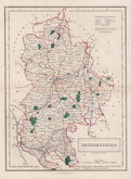
Sidney Hall 1830 [1846]
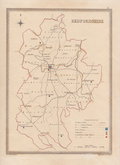
Roger Creighton 1831
Roger Creighton 1831
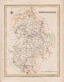
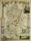
Gray & Son 1833
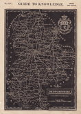
Joshua Archer 1833
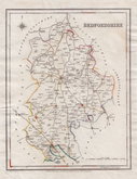
Roger Creighton 1835
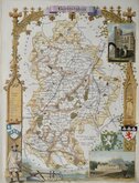
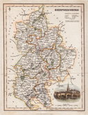
Thomas Moule 1836 [1852]
Thomas Moule 1836 [1852]


20x27 cm
HIGHLY DECORATIVE MAP WITH VIGNETTES AND ARMORIALS.
Bedfordshire
This series of decorative steel-plate engraved maps are commonly known by the name Thomas Moule as they were first issued from May 1830 in a series of parts of The English Counties Delineated. The engraving of the plates was shared between James Bingley, W. Schmollinger and John Dower. Confusingly the engravers names were changed after the first issue on a number of plates. Bedfordshire was engraved by William Francis Schmollinger (c.1811-1869).
Following the parts issue, the first complete edition of The English Counties Delineated was published by George Virtue in 1837 several editions followed until 1839 and the plates were used thereafter by George Virtue and his son James Sprent Virtue in A Complete and Universal Dictionary of the English Language by the Rev. James Barclay until 1857. The maps were frequently updated to reflect the rapidly developing railway network.
Small lower margin as often found with this map (but the farmer retains his feet!), otherwise a good looking decorative map in fine later hand colour from the final 1852 edition. Includes vignettes of Dunstable Priory and Woburn Abbey.
Ref. Betty Chambers Printed Maps of Bedfordshire 96 (vii)
SPECIAL OFFER MOUNT OPTION AVAILABLE AT CHECKOUT FOR UK POSTAGE
Quick Links

Berkshire Maps

Buckinghamshire Maps
×