
Magazines
Map Books
( Page 1 of 11 )
The Illustrated Longitude
Longitude
The Circumnavigators

Measuring the World Daniel Kehlmann
Nathaniel's Nutmeg
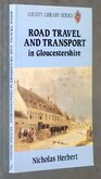
Road Travel in Gloucestershire
John Norden's Survey of Barley

Legal Luminaries Vanity Fair

Request Condition Report
The Printed Maps of Hertfordshire 1577-1900
By Donald Hodson
Dawsons of Pall Mall 1974
8vo. (19x25cm). Hardback red cloth. No dustwrapper. 251pp.
The standard reference work for the printed maps of Hertfordshire.
First published by The Map Collector's Circle 1969-1972, this is the first complete edition.
A detailed catalogue of 145 county maps with their various editions wth supplement on Ordnance Survey maps.
Some minor shelfwear but a good clean copy.
Quick Links
Antiquarian
Atlases & Road Books
×