
Atlases & Road Books
Map Books
( Page 4 of 14 )
Sphaerae Mundi

Atlas Major of 1665

The British Monarchy

Maps and Prints

The Magic Map
The Circumnavigators
John Norden's Survey of Barley
The Illustrated Longitude
£25
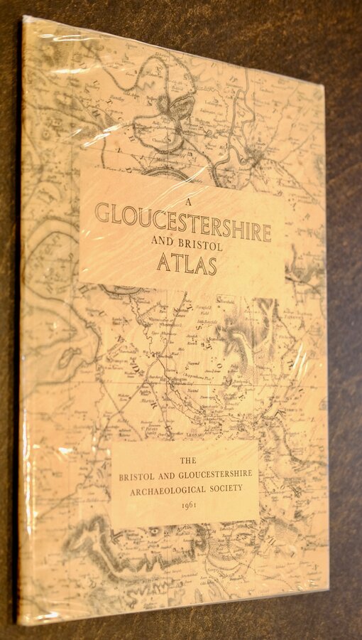
Bristol and Gloucestershire Archaeological Society 1961 Ref: Rb6483
Add to basket
Thanks,Your Product Has Been Added To Basket
Request Condition Report
A GLOUCESTERSHIRE AND BRISTOL ATLAS
A selection of old maps and plans from the 16th to the 19th century including the ISSAC TAYLOR (1777) large scale map of the county in full.
Printed for the BRISTOL AND GLOUCESTERSHIRE ARCHAEOLOGICAL SOCIETY by Percy Lund, Humphries & Co. Ltd, London and Bradford. 1961
Hardback blue cloth with gilt title to front board with dustwrapper. 25x36.5 cm. 24 pages.
Light spotting throughout otherwise in very good condition with very good protected dustwrapper.
Quick Links
Antiquarian
Magazines
×