
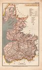
Yorkshire Maps
Lancashire Maps
( Page 1 of 3 )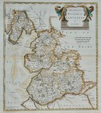
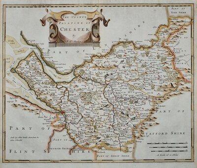
Robert Morden 1695

Emanuel Bowen 1720

Thomas Kitchin 1750 [c.1786]
Thomas Kitchin 1763
John Cary 1787 [1808]
John Cary 1789 [1805]
Henry Cooper 1808 [c.1825]

John Cary 1822


36x42 cm
FIRST FOLIO MAP OF THE COUNTY TO INCLUDE ROADS.
THE COUNTY PALATINE OF LANCASTER By Robt. Morden
Sold by Abel Swale Awnsham & Iohn Churchill
Copper engraving produced by Robert Morden for publication in Edmund Gibson's translation of William Camden's Britannia first published by Abel Swalle and Awnsham & John Churchill in 1695. This is the first series of maps to mark longitude in minutes of time (top border) as well as in degrees (bottom border). For most counties longitude is based on the meridian of St. Paul's, London.
The work was republished in 1722, 1730, 1753 and, finally in 1772. There were a number of minor alterations to most plates during the early editions and they were substantially updated for the 1722 edition mostly with changes to place name spellings. Due to wear caused by the printing process the plates were reworked for the 1753 edition.
Very good example of the map of Lancashire from the 1695 edition in neat later hand colour. Good margins all round
Quick Links

Cheshire Maps

Westmorland Maps
×