
Whole of Yorkshire
Yorkshire East Riding
( Page 1 of 2 )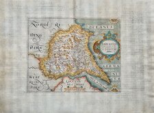
William Hole 1607
Robert Morden 1695
Emanuel Bowen 1720
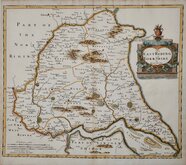
Thomas Kitchin 1763 [1777]
Thomas Kitchin 1764
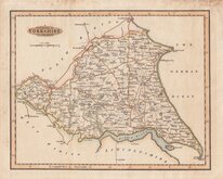
John Cary 1789 [1805]
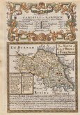
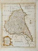
Benjamin Baker 1796
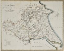
George Cole 1808


24x18 cm
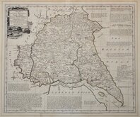
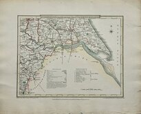
PARTS OF EAST AND WEST RIDING
YORKSHIRE PARTS OF THE EAST & WEST RIDING.
Drawn & Engraved by J. Archer, Pentonville, London.
First published in Curiosities of Great Britain, England and Wales Delineated…by Thomas Dugdale by L.Tallis in 1842. The work was re-issued a number of times until 1860. The maps also appeared in The Universal English Dictionary…by the Rev. James Barclay and finally in Tallis's topographical dictionary of England & Wales in 1860.
Joshua Archer (c.1792-1863), Engraver, cartographer and copperplate printer, born in Barnstaple in Devon. His first recorded work as an engraver was a map of Scotland for Robert Wilkinson in 1814. He was declared bankrupt in 1835, imprisoned for debt in 1845 but recorded as a map and chart engraver aged 69, on the 1861 census, living in Islington with his wife, Jane, a son, John, also a map and chart engraver, and Albert Archer, map and chart draughtsman, with his wife Elizabeth and three children.
This example is from the 1858 edition of Dugdale's Curiosities.
A good example in original wash hand colour.
Quick Links


Yorkshire North Riding

Yorkshire West Riding
×