
Cumberland Maps
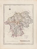
Westmorland Maps
( Page 2 of 4 )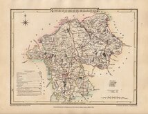
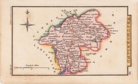
George Cole 1807
Henry Cooper 1808
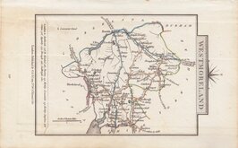
John Cary 1808 [1809]
Sidney Hall 1820
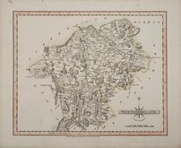
John Cary 1822
Roger Creighton 1831
Selina Hall 1831 [c.1835}
Roger Creighton 1831 [c.1840]


27x21 cm
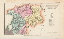
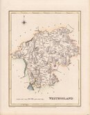
HIGHLY DECORATIVE VICTORIAN MAP.
WESTMORELAND.
This series of decorative steel-plate engraved maps are commonly known by the author of the work in which they first appeared; Moule's English Counties Delineated. First issued from May 1830 in a series of parts, the first complete edition was published by George Virtue in 1837. Several editions followed until 1839 and the plates were extensively used thereafter by George Virtue and his son James Sprent Virtue in A Complete and Universal Dictionary of the English Language by the Rev. James Barclay until 1857. The engraving of the plates was shared between James Bingley, W. Schmollinger and John Dower. The plates underwent a number of changes including the interchanging of engraver's names in the early issues and were frequently updated to reflect the rapidly developing railway network.
Thomas Moule was born in Marylebone on January 14th 1784. He was a bookseller in Grosvenor Square between 1816 and 1822. He was inspector of 'blind letters' in the General Post Office for forty years and also held the office of Chamber-keeper of the Lord Chamberlain's department which gave him an official residence in the stable yard, St. James's Palace, where he spent the later years of his life and died on January 14th 1851. Thomas Moule wrote a number of books on heraldry and antiquities, these interests being reflected in the decorative neo-gothic elements and coats of arms that surround his maps. It was this return to the decorative armorial cartography of the 17th and 18th centuries that contributed to the commercial success of his maps that remain popular to this day.
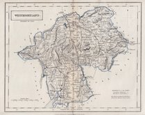
Stitch holes to top margin, otherwise a good clean example from the 1845 edition of Barclay's Dictionary, has sufficient margins and is in neat later hand colour. Vignettes of Brougham Hall and Appleby Castle keep.
Quick Links


Yorkshire Maps

Lancashire Maps
×