
Worcestershire Maps
Warwickshire Maps
( Page 1 of 3 )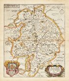
Richard Blome 1673
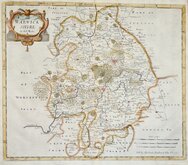
Robert Morden 1695
Emanuel Bowen 1720
Emanuel & Thomas Bowen 1767 [c.1770]
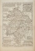
John Cary 1787 [c.1793]
John Haywood 1788
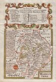
Edward Noble 1789 [c.1805]
Robert Butters 1803


18x24 cm
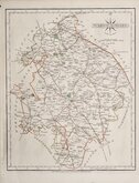
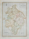
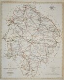
"DUGDALE" ORIGINAL COLOUR. 4TH ED.
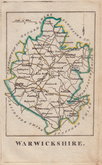
WARWICKSHIRE.
Drawn & Engraved by J. Archer, Pentonville, London.
Drawn and engraved by Joshua Archer for publication in Curiosities of Great Britain, England and Wales Delineated…by Thomas Dugdale.
The work was first published by L. Tallis in 1842 and was republished a number of times until 1860. The maps also appeared in The Universal English Dictionary…by the Rev. James Barclay and finally in Tallis's topographical dictionary of England & Wales in 1860.
This example in original outline hand colour, is from the fourth state of the plate published in 1848.
Harvey & Thorpe Printed Maps of Warwickshire ref. 99(iv)
SPECIAL OFFER MOUNT OPTION AVAILABLE AT CHECKOUT FOR UK POSTAGE
Quick Links


Staffordshire Maps

Leicestershire Maps
×