
Worcestershire Maps
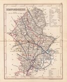
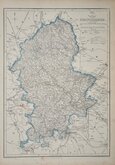
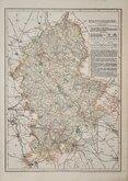
Staffordshire Maps
( Page 4 of 4 )

7x12 cm
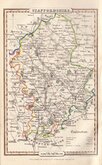
COLOURFUL MINIATURE MAP.
STAFFORDSHIRE.
Pub. by S.Leigh, 18,strand. | Sid.y Hall sculp.t
Miniature map engraved by Sidney Hall and first published in Leigh's New Pocket Atlas of England and Wales in 1820. The little atlas was popular, running to 10 editions until the final issues in 1842 and 1843 published by George Biggs.
Fine hand coloured example from the first edition.
Quick Links


Derbyshire Maps
Shropshire Maps
×