
England & Wales
Norfolk Maps
( Page 3 of 3 )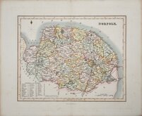
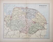
Gray & Son 1833 [1845]
Joshua Archer 1842 [1858]
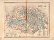
Francis Sidney Weller 1891
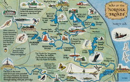
Norfolk Postcard 1960
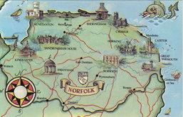
Norfolk Map Postcard 1970
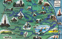
Norfolk Map Postcard 1970

£175
Richard Blome Richard Blome Ref: 6125xf
Add to
basket
Thanks,Your Product Has Been Added To Basket

33x25 cm
BASED ON SPEED.
A MAPP OF THE COUNTY OF NORFOLCK;
WITH ITS HUNDREDS BY RIC: BLOME, BY HIS MATY. ESPECIALL COMAND.
To ye Rt, Honebl, Hon: Earle of Norwich & Earle Marshall of England Baron Howard of Castle Riseing & Heir apparentto his grace ye Duke of Norfolk &ca This Mapp is Humbly dedicated by Ric: Blome.
Produced and published by Richard Blome, in Britannia: or, A Geographical Description of the Kingdoms of England, Scotland and Ireland...London, Printed by Tho. Rycroft for the undertaker, Richard Blome. 1673.
This series of maps were produced quickly, following an announcement in the press by John Ogilby of his intention to produce a new work of county maps, road maps and town plans entitled Britannia. Richard Blome shamelessly used the same title announced by John Ogilby for his work, and commenced publication in 1673. Blome’s maps are crudely engraved, typical of journeyman work, and mostly copied from those of John Speed, containing no new information. The printing, however, was of the highest standard, being carried out by Thomas Roycroft, printer to King Charles II.
Richard Blome (1635-1705), the son of bookseller Jacob Bloome and his wife Mary Adams, was baptised Richard Bloome, on 10th July 1635 at St Ann Blackfriars. In 1669 he was granted Royal Privilege by King Charles II giving him protection over his geographical books for twenty one years and later that year the king recommended the nobility and learned societies to subscribe to Blome’s work and requested that local justices, sheriffs, and mayors should offer him assistance. In 1673, when his Britannia was ready for the press, Blome petitioned the crown for a licence to publish a description of his Majesty’s dominions with maps and import 8,000 reams of royal paper duty free. He became Cosmographical Printer to King William III and Cosmographer to Queen Anne. Blome died in 1705 and was buried at Harlington, Middlesex, leaving his estate to Mrs Jane Hilton with whom he had lived many years, with bequests to the poor. His family disputed his will.
Britannia was probably on sale for four years. There was a re-issue of 1677 made up by John Wright from remaindered sheets.
Some toning to paper edges affecting the paper borders. Good example in neat later hand colour. Large fools-cap water mark.
Ref. Printed Maps of Norfolk Raymond Frostick [18.1]
Quick Links


Owen & Bowen

Cambridgeshire Maps
×