
Owen & Bowen
Norfolk Maps
( Page 3 of 3 )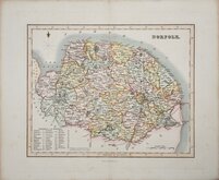
Gray & Son 1833 [1845]
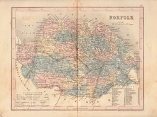
Joshua Archer 1842 [1858]
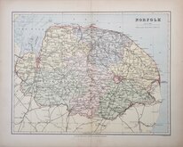
Francis Sidney Weller 1891
Norfolk Postcard 1960
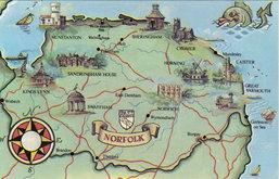
Norfolk Map Postcard 1970
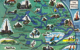
Norfolk Map Postcard 1970


28x21 cm
EARLY PRINTED COLOUR.
NORFOLK
F.S.Weller, F.R.G.S.
WILLIAM MACKENZIE, LONDON, EDINBURGH & GLASGOW.
Lithograph printed map from an engraving by Francis Sidney Weller, son of mapmaker Edward Weller, published by William Mackenzie in The Comprehensive Gazetteer of England and Wales issued in parts from c.1891 to 1895. The plate from which the lithograph was taken was never used for direct intaglio printing. The map is based on the New Series One Inch Ordnance Survey and has been overprinted in colours showing the county divided into administrative units.
Small red tick in right map border.
Quick Links


Cambridgeshire Maps

England & Wales
×