
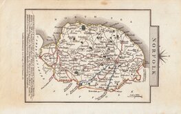
Owen & Bowen
Norfolk Maps
( Page 2 of 3 )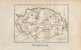
Robert Butters 1803
John Cary 1809
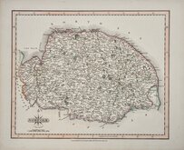
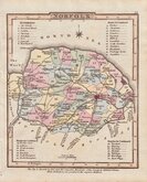
George Cole 1810 [1835]
Sidney Hall 1818
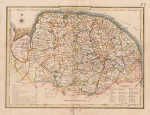
George & John Cary 1822
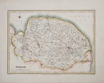
Charles Cooke 1822
Roger Creighton 1831
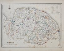
Roger Creighton 1831 [1840]


12x18 cm
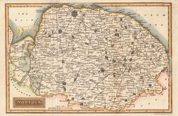
FROM THE "OWEN & BOWEN" POCKET ROAD BOOK BRITANNIA DEPICTA.
A MAP OF NORFOLK
Map set below cartouche containing the title and details of the road from Kings Lyn to Norwich.
Engraved description of the county below the map.
Road map showing the final part of the route from Kings Lyn to Harwich verso.
Engraved by Emanuel Bowen (1693?-1767) and published in the pocket road book Britannia Depicta by Thomas Bowles from 1720 to 1764. The county maps were based on Robert Morden's small series published in The New Description and State of England... from 1701.
Light crease across top left corner and light spotting to paper edges but still very good example in neat later hand colour.
Ref. Raymond Frostick Printed Maps of Norfolk [25.1]
Quick Links


England & Wales

Cambridgeshire Maps
×