
Middle East
Mediterranean
( Page 2 of 3 )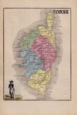
Corsica 1877
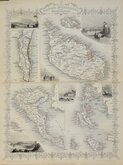
Mediterranean Islands Tallis 1851
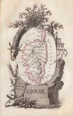
Corsica 1823
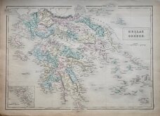
Greece by A & C Black 1840
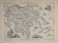
Greece by Rapkin 1851
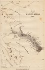
Mount Athos 1837
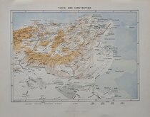
Tunis & Constantine 1885
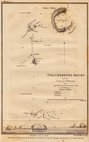
Columbretes Rocks. Captain Smyth 1831


47x32 cm
CENTRAL EUROPE | AND THE | MEDITERRANEAN COUNTRIES
Coloured lithograph published in The English Imperial Atlas and Gazetteer of the World by J. G. Bartholomew, F.R.S.E., F.R.G.S. London, T. Nelson & Sons, Paternoster Row. Edinburgh and New York. (1892)
Double page showing Europe and the Mediterranean with inset maps of Cyprus and Malta. Maps of Northern Asia and Palestine verso.
Quick Links
Spain & Portugal
Italy
×