
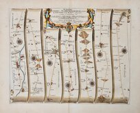
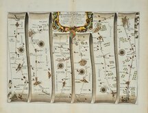
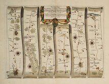
Roads by other Mapmakers
John Ogilby
( Page 4 of 5 )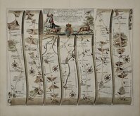
Barnet Oakham 1675
Barnsley Richmond 1675
Basingstoke Weymouth 1675
Bristol - Worcester 1675
Dartmouth Minehead 1675
Hereford Leicester 1675
Huntingdon - Ipswich 1675
Ipswich - Cromer 1675


45x36 cm
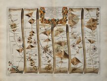
The Road from LONDON to BARSTABLE. in Devonshire. By JOHN OGILBY Esq.r His Ma.ties Cosmograph.r ...
From John Ogilby's Britannia.
Commencing at Andover on the Londo to Lands End road, this is the first part of the route to Barnstable and Truro and shows Andover, Monxton, Cholderton, Amesbury, Stonehenge, Shrewton, Norton Bavant, Boreham, Warminster, Maiden Bradley, Kilmington, Bruton, Ansford, Alford, East Lydford, Kingweston, Ashcott, Knowle, Bridgewater.
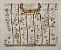
A short closed tear to the bottom margin but with generous margins, does not affect the plate area and the map is in fine condition, a strong dark impression from the first un-numbered edition of 1675 on heavy paper with a large fleur-de-lis and crown watermark and neat hand colour.
Later issues of 1675 were engraved with plate numbers in the lower right corners to assist the binder, this plate being numbered 32.
Includes original page of typeset text description of the route which includes a fine engraved head piece with the Stuart Arms flanked by mermaids holding flags displaying road maps around London and York and an engraved initial letter (I) showing threee surveyors, one using a plane table.
For more information on Ogilby and his work see category heading.
Quick Links
John Cary

Owen & Bowen
×