
Ordnance Survey Maps
Folding Maps
( Page 11 of 17 )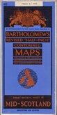
Bartholomew Mid Scotland 1951
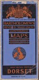
Bartholomew Dorset 1951
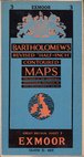
Bartholomew Exmoor 1952
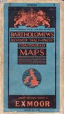
Bartholomew Exmoor 1952
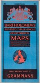
Bartholomew Grampians 1952
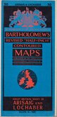
Bartholomew Arisaig and Lochaber 1952
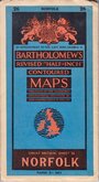
Bartholomew Norfolk 1952
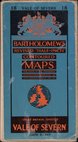
Bartholomew Vale of Severn 1953

Request
Condition Report
BARTHOLOMEW'S REVISED HALF-INCH MAP
FIRTH OF TAY
GREAT BRITAIN SHEET 49
THE EDINBURGH GEOGRAPHICAL INSTITUTE.
BY APPOINTMENT TO THE LATE KING GEORGE V.
Reduced by permission from the Ordnance Survey with local revision to date of publication. May 1950.
COPYRIGHT - JOHN BARTHOLOMEW & SON, LTD.
Cloth backed.
Condition: Very good.
Quick Links


English Counties

Regional Maps of England & Wales
×