
English Counties
Folding Maps
( Page 5 of 17 )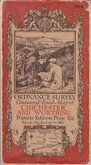
O.S. Chichester Worthing 1920
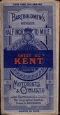
Bartholomew Kent 1922
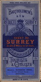
Bartholomew Surrey 1924
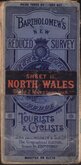
Bartholomew North Wales 1924
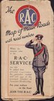
R.A.C. England 1925
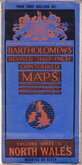
Bartholomew North Wales 1929
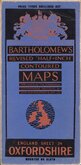
Bartholomew Oxfordshire 1929
Alfred Taylor 1930

Request
Condition Report
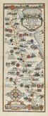
BARTHOLOMEW'S REVISED HALF-INCH MAP
TWEEDDALE
SCOTLAND, SHEET 5 (J3)
THE EDINBURGH GEOGRAPHICAL INSTITUTE
BY APPOINTMENT TO H.M. THE KING.
Reduced by permission from the Ordnance Survey with local revision to date of publication. 1937
COPYRIGHT - JOHN BARTHOLOMEW & SON. LTD.
Cloth backed. Owners dated signature to front cover.
Condition: Very good. Minor wear only.
Quick Links


Ordnance Survey Maps

Regional Maps of England & Wales
×