
English Counties
Folding Maps
( Page 4 of 17 )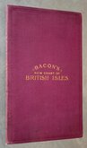
G W Bacon British Isles 1910
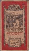
O.S. Bournemouth Swanage 1919
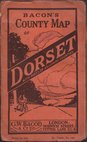
G W Bacon Dorset 1920
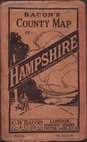
G W Bacon Hampshire 1920
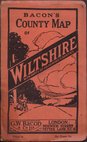
G W Bacon Wiltshire 1920
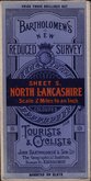
Bartholomew North Lancashire 1920
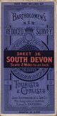
Bartholomew South Devon 1920
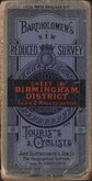
Bartholomew Birmingham District 1920


86x59 cm
BARTHOLOMEW'S REVISED HALF-INCH MAP
WHARFEDALE
GREAT BRITAIN. SHEET 32
PRINTED IN GREAT BRITAIN.
BY APPOINTMENT TO THE LATE KING GEORGE V.
Reduced by permission from the Ordnance Survey with local revision to date of Publication. 1960.
© — JOHN BARTHOLOMEW & SON. LTD. EDINBURGH. 9.
Cloth backed.
Condition: Good. Some wear at folds. A few marks in the margins.
Quick Links


Ordnance Survey Maps

Regional Maps of England & Wales
×