
English Counties
Folding Maps
( Page 6 of 17 )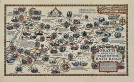
Alfred Taylor 1930
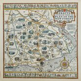
New Forest Alfred Taylor 1930
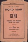
Geographia Kent 1932
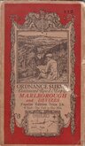
O.S. Marlborough Devizes 1932
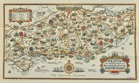
Alfred Taylor Pratts South Coast 1932
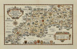
Alfred Taylor Pratts West Country 1932
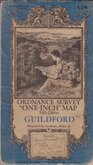
O.S. Guildford 1934
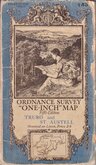
O.S. Truro St Austell 1934


71x42 cm
BACON'S LARGE SCALE PLAN OF THE CITY OF LONDON
Scale 12 inches to a mile.
Lithograph overprinted in colours. Pasted on linen. Map in fine condition, cover with inscription and stain to left edge. 15 page index to streets. No date but after 1900. (c.1910).
Quick Links


Regional Maps of England & Wales

Ordnance Survey Maps
×