
Six inch and 1:10000
Fifty inch and 1:1250
( Page 2 of 7 )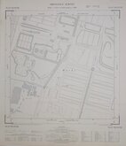
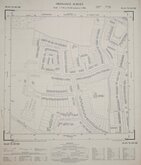
Edmonton Middx 1960
Loudwater Chorleywood Herts 1960
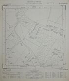
Hertford Sele Farm Herts 1962
Hertford Sele Farm Herts 1962
Hertford Sele Farm Herts 1962
Hertford Sele Farm Herts 1962
Amersham Bucks 1962
Ware Herts 1963

£10
Ordnance Survey Ordnance Survey Ref: TL0806NW
Add to
basket
Thanks,Your Product Has Been Added To Basket
Request
Condition Report
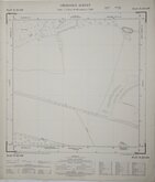
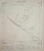
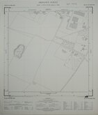
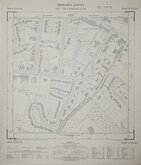
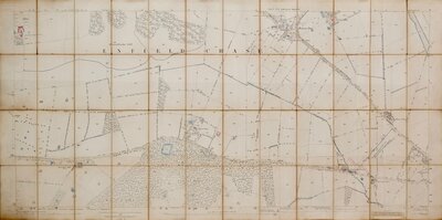
ORDNANCE SURVEY PLAN TL 0806 NW
Scale: 1:1250 or 50.688 inches to 1 Mile
Surveyed September 1966
Made and published by the Director General of the Ordnance Survey, Chessington, Surrey, 1967.
Includes roads: Leverstock Green Road, Bedmond Road, Halmes Road, Coniston Close, Derwent Road, Crossfell Road, Green Lane, Hartsbourne Way, Chelsing Rise, Burleigh Road, Poynders Hill.
Very good condition.
Quick Links

Twenty five inch and 1:2500

Other Large Scales
×