
Northumberland Maps
Cumberland Maps
( Page 1 of 6 )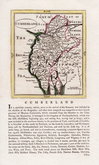
John Seller 1694 [1784]
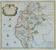
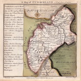
Robert Morden 1695 [1722]
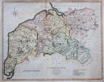
John Cary 1709 [1805]
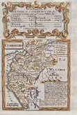
Emanuel Bowen 1720
Emanuel Bowen 1720
Thomas Badeslade 1742
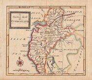
Thomas Read 1744 [1753]
Thomas Hutchinson 1748

£18
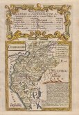
Roger Creighton Samuel Lewis Ref: 6189
Add to
basket
Thanks,Your Product Has Been Added To Basket

20x26 cm
SHOWING PARLIAMENTARY DIVISIONS.
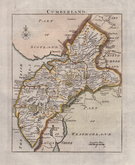
CUMBERLAND
Drawn by R. Creighton. | Engraved by J.& C.Walker.
Copper engraving by the firm of J & C Walker from a drawing by R. Creighton and printed by lithographic transfer for publication in A Topographical dictionary of England… published by Samuel Lewis and Co. from 1835-1840. The plates were not used for direct intaglio printing. The purpose of the map was to indicate the new parliamentary divisions and other electoral information; the otherwise shows only the county boundary, principal towns and main roads.
Good example with original outline hand colour.
Quick Links


Westmorland Maps

Scotland Maps
×