
Scotland Maps
Cumberland Maps
( Page 1 of 6 )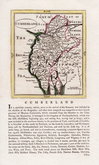
John Seller 1694 [1784]
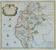
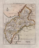
Robert Morden 1695 [1722]
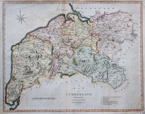
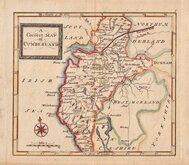
John Cary 1709 [1805]
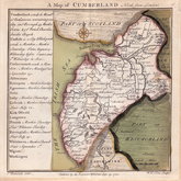
Emanuel Bowen 1720
Emanuel Bowen 1720
Thomas Badeslade 1742
Thomas Read 1744 [1753]
Thomas Hutchinson 1748


15x20 cm
FROM A REGENCY SCHOOL ATLAS. ORIGINAL COLOUR. UNCOMMON.
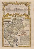
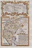
CUMBERLAND
Lithographic transfer from Reuben Ramble's regency school atlas, Travels through the Counties of England published by Darton & Clark (and Darton & Co.) between 1845 an 1850. Reuben Ramble was the pseudonym of Reverend Samuel Clark.
The small map was first issued, printed from the copperplate, in a set of playing cards by Thomas Crabb c.1819, followed by Miller's New Miniature Atlas... Robert Miller, 1821, and Darton's New Miniature Atlas...William Darton, 1822 & 1825.
Good example in original hand colour with original typeset text description of the county.
Uncommon.
SPECIAL OFFER MOUNT AVAILABLE AT CHECKOUT FOR UK DELIVERY.
Quick Links


Northumberland Maps

Westmorland Maps
×