
Bedfordshire Prints
Bedfordshire Maps
( Page 4 of 4 )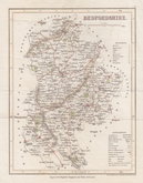
Joshua Archer 1842
Joshua Archer 1842 [1848]
Joshua Archer 1842 [1860]
F. P. Becker & Co. 1845
Benjamin Rees Davies 1859 [1864]
Benjamin Rees Davies 1859 [1867]
Francis Sidney Weller 1894

£10
Roger Creighton Samuel Lewis Ref: 8967gt
Add to
basket
Thanks,Your Product Has Been Added To Basket

18x25 cm
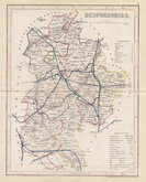
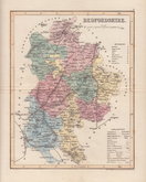
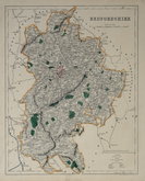
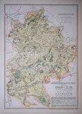
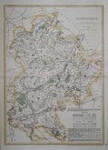
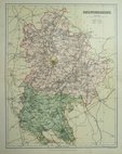
LITHOGRAPHIC MAP SHOWING ELECTORAL DIVISIONS OF THE COUNTY
BEDFORDSHIRE
Drawn by R. Creighton | Engraved by J.& C. Walker.
Lithographic transfer from an engraving by the firm of J & C Walker of a map drawn by Roger Creighton for Samuel Lewis' Topographical Dictionary of England…with a supplementary volume, comprising a representative history of England with plans describing the electoral divisions of the several counties… from 1831-1840. The plate was not used for direct intaglio printing. The map indicates only parliamentary information, county boundaries, the main roads and chief towns.
Original hand colour. Browning verso.
Betty Chambers Printed Maps of Bedfordshire Ref. 95A
Quick Links

Berkshire Maps

Buckinghamshire Maps
×