
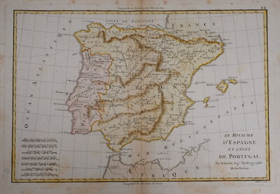
Spain & Portugal
Mediterranean
( Page 1 of 3 )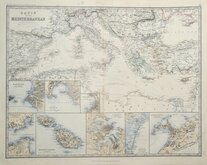
Mediterranean by Johnston 1893
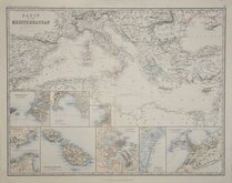
Keith Johnston 1893
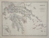
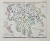
Greece Johnston 1893
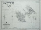
Astypalaia (Stampalia) 1941
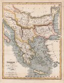
Greece Blackie & Co. 1827
Greece by Petermann 1860
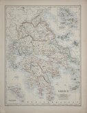
Greece Johnston 1884

Bizerte Tunisia 1845


47x32 cm
CENTRAL EUROPE | AND THE | MEDITERRANEAN COUNTRIES
Coloured lithograph published in The English Imperial Atlas and Gazetteer of the World by J. G. Bartholomew, F.R.S.E., F.R.G.S. London, T. Nelson & Sons, Paternoster Row. Edinburgh and New York. (1892)
Double page showing Europe and the Mediterranean with inset maps of Cyprus and Malta. Maps of Northern Asia and Palestine verso.
Quick Links
Middle East
Italy
×