
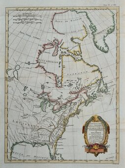
North America
Central America & West Indies
( Page 2 of 3 )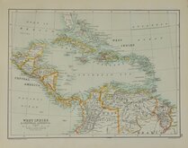
West Indies Central America 1892
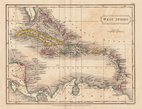
West Indies By Sidney Hall 1826
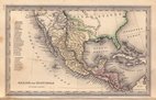
Mexico & Guatemala by Starling 1831
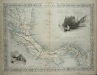
Central America by Tallis 1851
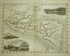
Panama by Tallis 1851
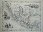
Mexico, California & Texas 1851
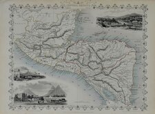
Central America by Tallis 1851
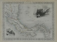
Panama by Tallis 1851


34x26 cm
ISTHMUS OF PANAMA.
The Illustrations by H.Warren, & Engraved by J.Wrightson.
The Map Drawn and Engraved by J.Rapkin
JOHN TALLIS & COMPANY, LONDON & NEW YORK.
This series of finely engraved and decorative maps were first published in parts from the end of the 1840's and issued as a complete work, The Illustrated Atlas, and Modern History of the World... in 1851. The work was published several times until about 1865, the maps were then used by Montgomery Martin, the author of the text for The Illustrated Atlas, in his British Colonies from 1854. The maps were later used with vignettes erased from the plate, in geographical dictionaries and encyclopaedia until about 1880
The construction of the Panama Railway began in 1850 just before publication of this map and the proposed railway is marked on the map and highlighted in red. The railway became a vital trade link and 50 years later the canal route was constructed alongside.
A very good example in original colour from the first edition of 1851. Without centrefold. Original typeset text description included.
SPECIAL OFFER MOUNT AVAILABLE AT CHECKOUT (UK Only)
Quick Links

Sea Charts

South America
×