
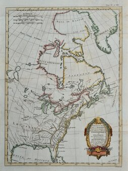
Sea Charts
Central America & West Indies
( Page 2 of 3 )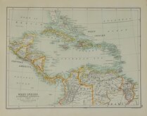
West Indies Central America 1892
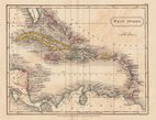
West Indies By Sidney Hall 1826
Mexico & Guatemala by Starling 1831
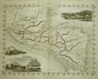
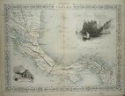
Central America by Tallis 1851
Panama by Tallis 1851
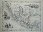
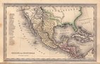
Mexico, California & Texas 1851
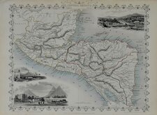
Central America by Tallis 1851
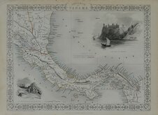
Panama by Tallis 1851


£200 Mexico, California & Texas
Ref: a6031.73
Add to
basket
Thanks,Your Product Has Been Added To Basket

34x26 cm
MEXICO, | CALIFORNIA AND TEXAS.
JOHN TALLIS & COMPANY LONDON & NEW YORK.
The Illustrations by H. Warrren & Engraved by J. Rogers. | The Map, Drawn & Engraved by J. Rapkin.
This series of finely engraved and decorative maps were first published in parts from the end of the 1840's and issued as a complete work, The Illustrated Atlas, and Modern History of the World... in 1851. The work was published several times until about 1865, the maps were then used by Montgomery Martin, the author of the text for The Illustrated Atlas, in his British Colonies from 1854. The maps were later used with vignettes erased from the plate, in geographical dictionaries and encyclopaedia until about 1880.
The map depicts a transitional period in the unsettled political configuration of Texas, New Mexico and California. Includes key to The Newly discovered Gold districts and vignette of Gold washing erased from later editions.
Vignettes of Gold Washing, Mexican Peasantry and Ruins at Uxmal, Yukatan.
A very good example from the first edition without centrefold in original outline hand colour. With accompanying page of typeset text description.
SPECIAL OFFER MOUNT AVAILABLE AT CHECKOUT (UK Only)
Quick Links


South America
North America
×