
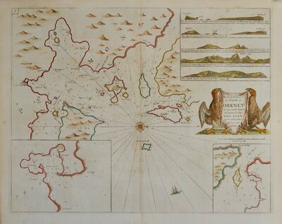
Sea Charts
Channel, Scilly and other small islands.
( Page 1 of 2 )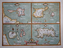
John Speed 1676
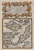
Emanuel Bowen 1720
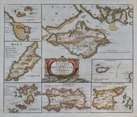
Robert Morden. 1753
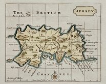
Jersey by John Seller 1787
John Cary 1805

Jersey. Roger Creighton 1831
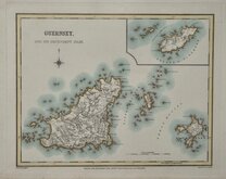
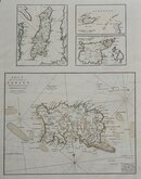
Guernsey. Roger Creighton 1831
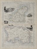
Channel Islands. John Tallis 1851


52x39 cm
HOLY ISLAND | GARNSEY | FARNE | JARSEY
Performed by John Speede, and are to be solde by Thomas Bassett in Fleet Street and Richard Chiswell in St Pauls Churchyard.
Copper engraving by Jodocus Hondius from John Speed's Theatre of the Empire of Great Britaine.
John Speed (1552-1629), born in Cheshire, was a Tailor, becoming a member of the Worshipful Company of Merchant Taylors in 1580. He became interested in History and antiquities and became a member of the Society of Antiquaries and friend of William Camden. In 1611 he published his History of Great Britaine followed by his Theatre of the Empire of Great Britaine the following year. The Theatre was designed as the topographical section to his History and the inclusion of county maps with inset town plans has ensured Speed's name will be remembered. The maps were designed and engraved by Jodocus Hondius in Amsterdam from materials and instructions sent to him by Speed. Speed's main cartographical contribution was the town plans, Speed claiming authorship to those that include a scale of paces "by mine owne travails". The county maps are based on the surveys of Christopher Saxton and John Norden. The inclusion of the internal administrative divisions of the counties was a new innovation by Speed perpetuated in most county maps that followed for the next 300 years. The descriptive text on the back of the maps is taken from Camden and as the text had to be re-set for each issue enables us to date an individual map. On 29th April 1608 George Humble obtained the rights to print and sell the atlas for 21 years but publication did not actually start until 1611. Publication of John Speed's maps continued by various publishers until at least 1770, a publication period of 160 years.
Fine example of Speed's map of the Islands of Great Britain is from the 1676 edition published by Thomas Bassett and Richard Chiswell. Good impression for this edition in fine later hand colour. Good margins all round. Clean and undamaged.
Quick Links
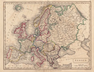
Europe

British Isles
×