
Map Books
Atlases
( Page 1 of 4 )
Ogilby Traveller's Guide 1712
Cox Magna Britannia Hertfordshire 1720
Magna Britannia Hertfordshire by Thomas Cox 1720
Senex Norden Speculum Middlesex & Hertfordshire 1723
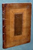
Senex Norden Speculum Middlesex & Hertfordshire 1723
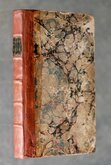
Mostyn Armstrong Great Post-Roads 1783
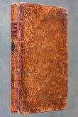
Paterson British Itinerary 1785
The Great Road From London to Bath & Bristol 1792


Request Condition Report
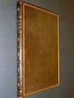
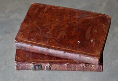
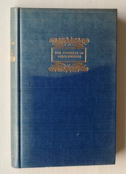
BRYCE'S PEARL Atlas of the World
CONTAINING SEVENTY-TWO MAPS
EDITED BY L.W. LYDE,
Extension Lecturer on Commercial Geography to the Universities of Glasgow & Oxford.
GLASGOW; DAVID BRYCE & SON. 1893.
64mo. (6x8.5cm), Grey cloth, Illustrated title to front board, Pears' Soap advertisement to back board, Lighthouse illustration with title to spine. All edges red. Blue endpapers. Half title | Title | Preface | 3pp. contents | 128pp. chromolithograph printed maps (see pagination note and map list below).
First published as The Pearl Atlas of the World...New York; Frederick A. Stokes Company, [1893], this is the first UK edition published in the same year as Bryces Pearl Atlas of the World...Glasgow; David Bryce & Son. 1893.
Later editions included a promotional issue for Gustav Mellin's Food in 1894, and, best known, as a part of the "Knowledge in a Nutshell" series issued from 1904 to about 1913 by various publishers. "Knowledge in a Nutshell" included an English Dictionary, a Gazetteer of the World, and a Book of General Information.
The pagination for the first American edition began with World and American maps from IX to XXVII followed by the rest of the world from 1-108. This British edition begins with the World maps IX-XII followed by the rest of the world from 1-108 with the American maps XIII-XXVIII at the end.
The maps are mostly double page and printed on both sides of the page. Titles are at the top of the page. Single page maps noted [sp] below:
The World (twin hemispheres) [sp]. The World - Mercator’s projection. North Atlantic Ocean. South Atlantic Ocean. Europe–physical. Europe–political. South Europe. The British Isles–in relation to the Continent. England & Wales (River systems.). England & Wales Railways. London. England Northern counties. England –Lancashire & Yorkshire England – Midland counties. England – Eastern counties. England – South-eastern counties. England – South-western counties. Wales. Scotland (Political & Railways). Central Scotland. Southern Scotland. Ireland –(River systems). Ireland – Ulster [sp]. Ireland – Leinster [sp]. Ireland–Connaught Ireland – Munster. France. Switzerland. Holland & Belgium. Norway, Sweden and Denmark. Russia in Europe. Germany (Political). Austria - Hungary. South-east Europe [sp]. Asia Minor [sp]. Roumania [sp]. Servia, Bosnia & Montenegro [sp]. Italy. Spain & Portugal. Greece & Candia (Crete). The Alps Water-shed. Asia. Palestine. Central Asia. India (Political). Farther India. China & Japan. Africa. Egypt. Central Africa. South Africa. Australasia. New South Wales. Victoria. Queensland. Districts of Adelaide, Perth, Palmerston, Hobart & Launceston. New Zealand – (North Island). New Zealand – (South Island). Dominion of Canada. Canadian Pacific Railway. Nova Scotia & New Brunswick [sp]. Ontario & Quebec [sp]. Central Canada, (Manitoba &c). America [sp]. North America. United States – (Western). United States – (Central). United States – (Eastern). New York. West Indies. South America. Central America [sp].
The maps were produced by George Philip & Son and also appeared in Pear's Cyclopaedia also produced by Bryce.
A fine example of the uncommon first British edition of this nearly miniature atlas with only minor wear to boards and spine, slight loosening at gatherings but contents clean and undamaged throughout.
Quick Links
General & Collectable
Antiquarian
×