
Historical Maps
World Maps and Charts
( Page 1 of 4 )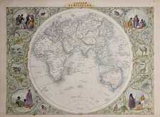
John Tallis Pair of Maps 1851
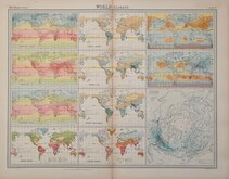
World Climate Bartholomew 1922
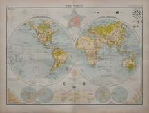
Bartholomew Twin Hemisphere 1898
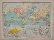
British Empire Bartholomew 1898
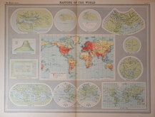
John Bartholomew 1922
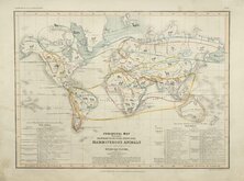
Petermann Mammals 1854
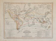
Petermann Birds and Reptiles 1854
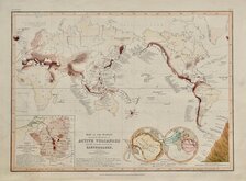
Petermann Volcanoes Earthquakes 1854


£250 John Tallis Pair of Maps
Ref: 6437bg
Add to
basket
Thanks,Your Product Has Been Added To Basket

36x27 cm
Pair of World Maps.
EASTERN HEMISPHERE & WESTERN HEMISPHERE
JOHN TALLIS & COMPANY. LONDON & NEW YORK
The `Illustrations by H.Warren & Engraved by J.Rogers.
The Map Drawn & Engraved by J. Rapkin.
Surrounded by vignettes in decorative borders.
Original colour to maps with later colouring to vignettes. Stich holes at bottom margin affecting the imprints.
Price is for the pair of maps.
Quick Links
Celestial
Atlantic & Poles
×