
Ordnance Survey Maps
War Issue Maps
( Page 13 of 14 )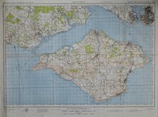
Isle of Wight 1942
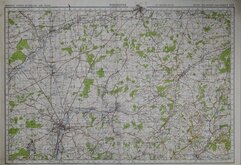
Winchester 1942
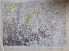
N E London and Epping Forest 1942
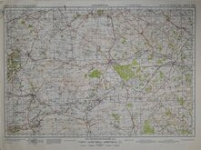
Marlborough 1942
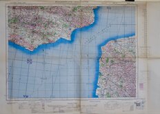
Folkestone - Boulogne 1943
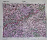
Chemnitz 1943
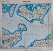
Rostock 1943
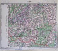
Trier 1943


71x54 cm
ORDNANCE SURVEY OF ENGLAND AND WALES
ISLE OF WIGHT
5TH EDITION STYLE
SECOND WAR REVISION 1940 SHEET 142
Geographical Section, General Staff, No. 3907.
Published at the War Office, 1941.
Ordnance Survey 1942.
Unfolded. Closed tear bottom edge not affecting printed area
Quick Links

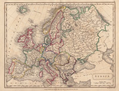
Europe

Folding Maps
×