
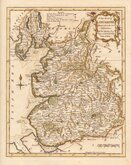
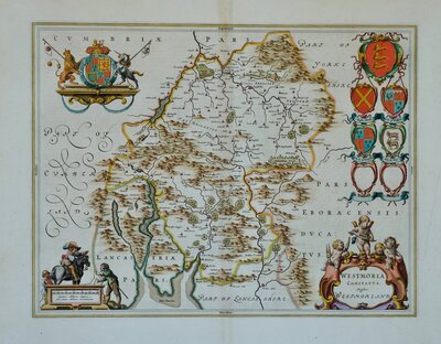
Westmorland Maps
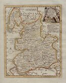
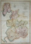
Lancashire Maps
( Page 1 of 3 )
Emanuel Bowen 1720
Thomas Badeslade 1741
Thomas Kitchin 1763
Thomas Kitchin 1786
Benjamin Baker 1793
Robert Butters 1803
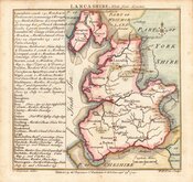
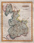
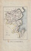
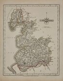
John Cary 1805
John Cary 1808


37x52 cm
A | MAP | of | LANCASHIRE | from the best | AUTHORITIES | Published by John Stockdale Piccadilly 26th march 1805. | Engraved by J. Cary.
Copper engraving by John Cary first published in parts by T. Payne & Son,and G.G.J. & J. Robinson in Richard Gough's translation of William Camden's Britannia from 1789. Following the death of Payne, the Robinson family sold the plates and publication rights to John Stockdale. Richard Gough ceased working on the project and Stockdale completed the editorial work himself, expanding the work to four folio volumes and publishing them in 1806. Stockdale also used the plates in his New British Atlas from 1805 to 1809.
Stockdale edition dated March 1805 Line and wash hand colour. Some offsetting - see detail.
Quick Links
Yorkshire Maps
Cheshire Maps
×