
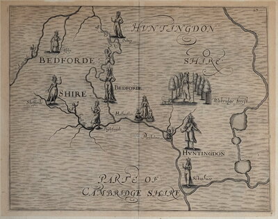
Regional Maps
Folding Maps
( Page 3 of 18 )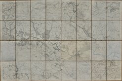
Ilkley and Otley 1895
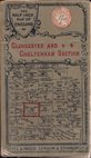
Gall & Inglis Gloucester 1900
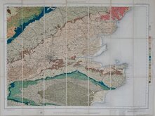
O.S. Geological. South East 1901
Bartholomew Cheshire 1904
O.S. Weymouth 1908
Bartholomew Wexford 1910
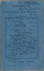
Bacon. London. 1910
Archibald Geikie Geological 1910


193x129 cm
YORKSHIRE. (WEST RIDING) Sheet CLXIX
YORKSHIRE. (WEST RIDING) Sheet CLXX
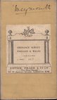
Surveyed in 1847_8. Revised in 1889_91.
Engraved and Published at the Ordnance Survey Office, Southampton,1895.
Re-surveyed in 1889_91 Published in 1894.
Four full sheets joined, segmented and pasted on linen. The titles above are from the top two sheets and the imprints from the bottom two sheets. The map is made up from three full sheets (old 3ftx2ft size), top and bottom left, and four quarter sheets (18x12 inches) , bottom right. The quarter sheets have slightly varying tones and have the water features hand-coloured blue. The three full sheets are intaglio printed from the copper plate and the four quarter sheets are photo-reduction printed.
The map extends from Beamsley in the north-west to Bramhope in the south-east and includes Timble, Norwood, Stainburn, Castley, East Carlton, Otley, Burley in Wharfdale, Ilkley, East Morton.
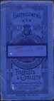
Segmented into 32 sections 32x25cm. Burgundy cloth covers with paper label: Ordnance Map. No...(Ink inscription: Ilkley & Otley District) HENRY GASKARTH, SUN BRIDGE BUILDINGS, BRADFORD, AGENT BY APPOINTMENT.
Stain to front cover and label, light fraying to edges but generally very good.
Quick Links

English Counties

Ordnance Survey Maps
×