
Sea Charts
Australasia & Pacific
( Page 1 of 6 )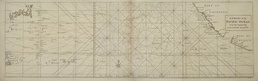
Pacific Ocean by Anson 1748
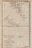
Vanuatu & New Caledonia Cook 1776
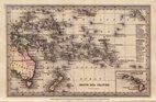
South Sea Islands by Starling 1831
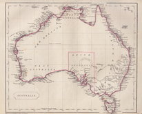
Australasia by Pinnock 1834
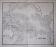
Pacific Islands by Johnston 1843
Australia by Becker 1850
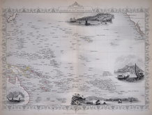
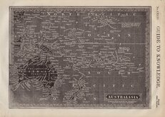
Polynesia by Tallis 1851
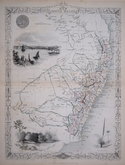
New South Wales by Tallis 1851


33x26 cm
Drawn and engraved on steel by John Rapkin with illustrations by J. Marchant, engraved by J.B.Allen. Published in The Illustrated Atlas and Modern History of the World...Edited by R. Montgomery Martin Esq. by John Tallis and Company, London and New York 1851.
Showing Australia divided into West Australia (26 counties), New South Wales (46 counties), South Australia (undivided) and Victoria or Port Philip (24 counties).
Vignettes of Sydney, Kangaroos, Parrots and Cockatoo, Natives of Australia Felix and of Bogan. Decorative border.
Slight grubbiness outside the printed borders but a good example without centrefold in original outline hand colour from the first edition. With accompanying page of typeset text description of Australia or New Holland (some juvenile scribbling to bottom border of text page).
Quick Links
Africa
Far East & India
×