
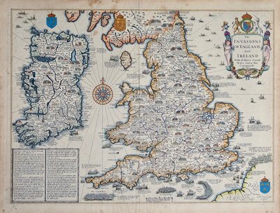
British Isles
Atlantic & Poles
( Page 1 of 2 )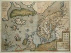
North Atlantic Ortelius 1608
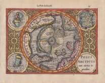
North Pole Mercator 1608
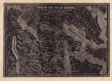
Polar Regions Archer 1833
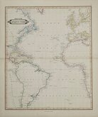
Atlantic by Lizars 1842
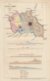
Santa Maria Azores Geological 1845
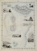
Atlantic Islands Tallis 1850
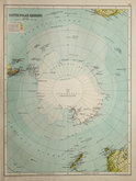
Antarctica by Bartholomew 1892
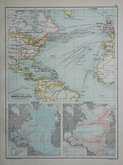
North Atlantic 1892


24x32 cm
SKETCH CHART OF THE | NORTH ATLANTIC | ON MERCATORS PROJECTION || DEPTHS || CURRENTS |
Colour printed lithograph with colour printed lithograph printed maps of Canada verso and on adjacent page by John Bartholomew & Co. published in The English Imperial Atlas and Gazetteer of the World By J. G. Bartholomew, F.R.S.E., F.R.G.S. London T. Nelson & Sons, Paternoster Row Edinburgh and New York (1892)
Note: Canada maps printed alongside and verso are also listed under North America Category but are not a separate maps and price is for all three maps.

×