
Road Maps
Town Plans
( Page 1 of 13 )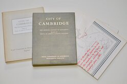
Cambridge, King's St. John's & Trinity
Ely 1729
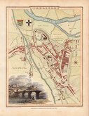
Durham 1804
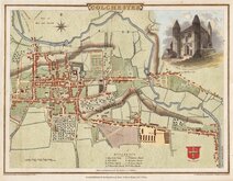
Colchester 1805
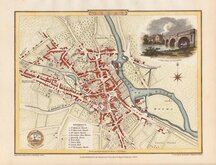
Carlisle 1805
Derby 1806

Norwich 1807
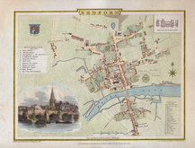
Bedford 1807


£20 Cambridge, King's St. John's & Trinity
Ref: 7627wh
Add to
basket
Thanks,Your Product Has Been Added To Basket
CITY OF CAMBRIDGE
Map showing position of Monuments
Plans of King's, St. John's & Trinity Colleges
Royal Commission on Historical Monuments England.
HMSO
22x27cm. Cloth lined clam shell box with paper slip case containing a map of Cambridge and three college plans:
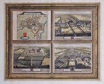
Map of Cambridge.
ROYAL COMMISION ON HISTORICAl MONUMENTS
CITY OF CAMBRIDGE
Map showing the position of MONUMENTS
Scale six inches to one mile, or 1: 10,560
87.5cm x 119cm.
Three plans at a scale of 1/16th of an inch to one foot.
The KING'S COLLEGE of Our Lady and Saint Nicholas in Cambridge
86.5cm x 82.5cm.
ST. JOHN'S COLLEGE
151cm x 63.5cm.
TRINITY COLLEGE
1010mm x 1190mm.
Paper slipcase has some minor chipping to top and bottom edge, otherwise all in very good condition.
Quick Links


London Maps
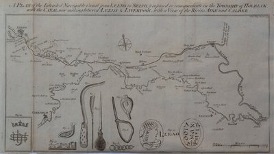
Waterways & Railways
×